
The landscape of the Golden State is one of the main reasons I moved to the west coast. Mountains, canyons. beaches, ocean...it's hard to beat the beauty of California. In the last two years, I lost track of that landscape and beauty, buried in traffic and under my monthly budget.
This year will be a different story. I keep my D90 in the car pretty much every day. I already made good use of an impromptu day down to San Diego, early in the year, by driving back up Highway 1 along the coast. That morning produced a lot of feel good images and set a great tone for the year.
As January rolled on, I kept looking for opportunities to take a break from traffic and take in more Southern California nature. I've mentioned it a couple of times previously, but right now, I drive for a couple of rideshare apps to make ends meet as I keep focusing on the future and finding where my passion for photography (and film) lands in the world. Needless to say, I'm spending a lot of time in the car and on the road. My normal daily routine would consist of waking up early and driving in the morning. At some point the heat and traffic would drain me so I would retreat back to my apartment in Pasadena for a short break, and then get back in the car for a few more hours. I'd wake up the next day and do it all over again. No adventure, no extra curricular activities. Just drive, eat, Netflix, and sleep. But that pattern has ended.
With the D90 in the car, and with hiking shoes on most days, I have been looking for places to go, to escape the city and photograph the landscape for an hour or two. It is incredibly freeing and feels healthy in many ways. The sources of my locations have been varied. I've always been a DiscoverLosAngeles.com fan and I find a few locations through their site and Facebook page. My passengers are often native Angelenos and they will share a cool spot from time to time. But the biggest gold mine came from a rideshare passenger in the middle of the month. We struck up a conversation about hiking and I told him I had been doing these mini excursions and he asked if I had the "All Trails" app.
The what?
Exactly as the title suggests, it's an app dedicated to hikers that will share information about all the trails near your current location. It is been a perfect gift. After opening the app, you simply click, "explore" and a list of hiking trails near you pops up, with photographs. You're given details about the location, length, difficulty and features of the trail (does it have a waterfall, views, flowers, etc). You can also record your progress (so you don't get lost), take photos, and later rate the trail and leave a comment for future hikers. Brilliant.
Rideshare driving can take you to any place in Los Angeles County. You never know where you'll end up. When I feel like taking a break, I'll open the All Trails app and see what looks interesting nearby. All that said, it's time for a few images. Here are the handful of small hikes and attractions I visited during the month of January 2017:
Eaton Canyon
I had heard of Eaton Canyon for a long time, and I also took a look at its page on the All Trails app. This is about a 3.5 mile trail not too far from Pasadena. I've dropped off many passengers here and always thought, "one day." I heard there was a waterfall at the end of which made it all the more alluring. On a random Tuesday, it was time...
As you can see with the electrical tower and power lines above, it's not completely remote and removed from civilization, but the landscape below suggests you're not in the city anymore:


The main experience of the Eaton Canyon trail is that you are guided by a stream all the way to the waterfall, and you cross over the it many times until the end of the trail. There are no bridges or walkways to help you to the other side, so each crossing is a miniature puzzle; do you use the overturned branches or the rocks?


At the end of all the hopping and skipping is the gem of the trai, the waterfall. It's a pretty peaceful moment, and makes the trek worthwhile:


Here's a shot with two people standing around the base of the falls, to give a sense of scale. They are about 25' high:

I'm starting to learn a few hiking terms. Eaton Canyon is an "out and back" trail which simply means it's a trail that you hike in to and journey to a specific point and then exit the way you came. The alternative or opposite would be a "loop" trail. On the way back, I captured a few more images, just enjoying the textures and light outdoors. It really had been a while since I just enjoyed simple things in nature like the way light hits rocks...

...or the texture of water...


This final shot is a "thank you" to God for all the rain we've been getting in Southern California this year. Drought, drought, drought, is all we've had for a few years now. After a few days of rain, things got green again. Nice hillside view:

point dume
The following day, I found myself near Malibu and decided to venture up to Point Dume, a small reserve with a few bluffs overlooking the Pacific. When I arrived, I was greeted by overcast skies, a roadside fence, and rich grassy hillside. I thought to myself, "this must be practice for Hawaii..."
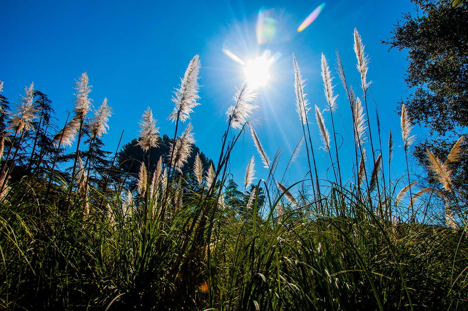
A subplot to this post, which should honestly be the main plot, is the awesome variation of the Southern California landscape. A day previously I was looking at a desert thicket with a stream and waterfall, and the next, an oceanside grassy hill with cacti and wildflowers:

Also, of course, Point Dume also contains steep bluffs and coastal views:


The following ended up being my favorite view of the day. A small cliff overlooked the water and was high enough that you were among the birds:


I'm glad I took the time to explore this area. At the end of a little climbing is a flattened plateau with a 360 degree view. An engraved plague can be found describing the discovery of the Point, which was named after a Spanish Franciscan missionary, Francisco Dumetz. The resulting name, "Dume" was a typo that stuck:
Franklin Canyon Park
A week later, the All Trails app helped me find the next small adventure: Franklin Canyon Park. It is a landlocked public park nestled in the Santa Monica mountains which features a 3 acre reservoir within 605 acres of total park area. It has been a popular location for film and television (there was actually a small crew there on the day I visited), and was even the location of album cover photographs for The Rolling Stones and Simon and Garfunkel.
Before showing images of the Park, I thought I'd throw in this sunrise shot. On the same morning as visiting Franklin Canyon I was able to capture this fire in the sky in the Hancock Park neighborhood:
Later in the day, I would venture to Franklin Canyon Park, and the first photogenic moment I would encounter was not a grand vista of the Park, but of animals. There were several ducks bathing and relaxing near the edge of the resevoir. I don't think I've ever been this close to ducks, or any bird for that matter without it freaking out and flying away. They were used to the attention. They were "people ducks:"
Round of applause for the Nikon D90 for picking up the subtlety of light and the texture of the feathers:
Once I began the 2 mile walk around the reservoir, Franklin Canyon Park did not disappoint and again gave me another "flavor" of Southern California. It was not a desert, beach or bluff this time, but a forested almost swampy walk:
The best part of the day was the resevoir, which started to produce some fun reflection images:

Korean Bell of Friendship
In 1976, to celebrate the bicentennial of the United States of America, and as a gesture of friendship between the two nations, the Republic of Korea built and dedicated a pavilion housing a bronze bell at Angels Gate Park in San Pedro, CA.
Pretty straightforward, it has become a popular attraction known as the Korean Bell of Friendship or more commonly, the Korean Friendship Bell. A few times, I would mention to rideshare passengers that I am a photographer and they would perk up, "Oh! You have to go see the Korean Friendship Bell!" Actually, one passenger in particular was very adamant about it. I cannot remember her name, but she is not forgotten. On the driver's app for Uber, they have a ratings section and you can see your driver rating along with any comments that passengers leave for you. From time to time, I will scroll through to see what comments passengers left. Usually it's common stuff like, "Great drive!" or "Thanks Mallury!" As I was scrolling through one day, I saw a comment from October of 2015 that read, "This guy is awesome. Don't forget the Korean Bell!"
One year and three months. That's how long the Korean Friendship Bell had been on my mind... Glad I finally made it. Plain and simple, it was awesome:


Angel's Gate Park was not to be without great views of the coastline and Pacific:

Hollywood trivia: fans of the film, the Usual Suspects will recognize the Pavilion as it was one of the filming locations:


What would my life be like without silhouette shots? (I don't want to know):

On my way back north into Los Angeles that day, I caught a nice view over Long Beach which contained a snow covered peak in the distance:

Huntington Beach
Lastly, there was a morning sunrise at the Huntington Beach Pier. I'd been there before in 2015 and it so happened that rideshare had taken me all the way down there from Pasadena one morning. The sun was not quite over the horizon yet and the sky glowed a great orange and purple. I had to stop:


Thanks, California, for a great start to the year. Here's hoping that it's just the beginning...
Also see...


